 Faults of the Bohemian Massif
Source of Analytical Data on Main Faults and Faulted Areas with Seismic Potential
User Tools
zelezne_hory_fault
Media Manager
Namespaces
Choose namespace


Media Files
Files in dbz

- budkovice-profiles.jpg
- 3112×1831
- 2019/07/19 12:13
- 576.2 KB

- dbf_overview.jpg
- 890×1148
- 2020/05/18 16:47
- 359.3 KB

- dbz_smallmap.jpg
- 1020×746
- 2019/07/18 16:28
- 281 KB

- hosteradice-profile.jpg
- 964×481
- 2019/07/18 16:28
- 128.6 KB

- hosteradice-trench.jpg
- 1455×644
- 2019/07/18 16:28
- 214.2 KB

- kadov-profile.jpg
- 964×543
- 2019/07/18 16:28
- 148.4 KB

- kadov-trench.jpg
- 1214×832
- 2019/07/18 16:28
- 226.5 KB

- lechovice-profile.jpg
- 2323×876
- 2019/07/22 17:08
- 683.4 KB

- lechovice_blow.jpg
- 677×1068
- 2019/07/22 17:08
- 364.7 KB

- lesonice_les-p1.jpg
- 2745×925
- 2019/07/19 12:03
- 535.7 KB

- limberg.jpg
- 2351×953
- 2019/07/22 16:52
- 254.4 KB

- schonhubel.jpg
- 1301×839
- 2019/07/18 18:16
- 334.7 KB

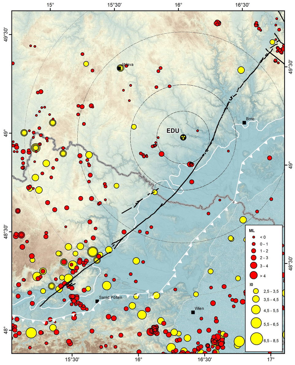
- seismicity.jpg
- 962×1193
- 2020/05/18 17:06
- 316.6 KB

- stosikovice.jpg
- 1740×1049
- 2019/07/22 17:18
- 661.7 KB

- tasovice-dike.jpg
- 649×784
- 2020/05/07 22:48
- 182.6 KB

- tasovice-trench.jpg
- 1873×976
- 2020/05/07 22:48
- 292.8 KB


![[root]](/doku.php?id=zelezne_hory_fault&ns=&tab_files=files&do=media&tab_details=history&image=dbz%3Aseismicity.jpg)
File
History of dbz:seismicity.jpg
| 2020/05/18 13:00 petrs created |
2020/05/18 17:06 (current) petrs metadata edited |
|---|---|
 |  |
zelezne_hory_fault.txt · Last modified: 2022/12/06 17:25 by petrs
Page Tools
Except where otherwise noted, content on this wiki is licensed under the following license: CC Attribution-Share Alike 4.0 International
